Table of Contents
Arcs
Command: ARC BM
Description
The command draws two lines to determine a position. On a construction site, this can be measuring a point for tree planting.
Application
- Immediately after calling the command you will be asked to select the first base point (A).
- Then select the point to be measured (X). The first route is drawn.
- With the selection of the second base point (B), the second route is drawn in and the command is completed.
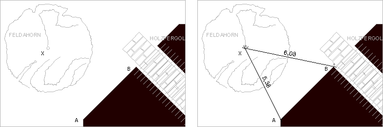
Functionality
With this point determination method, any point (X) is determined from two fixed points A and B by measuring the distance from A and B to point X.