Table of Contents
Bing Maps import
Command: DFBIMPORT
Description
With this command you import the current map section from Bing Maps into your drawing. You can use this as a basis for planning or as an overview map, for example.
The map section visible in Bing Maps is displayed in DATAflor CAD inserted as a colored pixel image. The Gauß-Krüger coordinate range is used and the image is automatically aligned to the north. It is possible that this will insert the image rotated.
Features
Import image
Inserts the visible map section into the drawing as a colored pixel image.
All images are on the layer Bing Maps import inserted.
Import terrain data
Creates one based on the elevation of the terrain from Bing Maps Point set. The point set is invisible. The settings can be made in Quick DGM be adjusted.
The point set is on the layer 0_DGM_PointSet_BING_MAPS
In addition, a triangulation created. The settings can be made in Quick DGM be adjusted.
The surface is on the layer 0_DGM_Triangulation_BING_MAPS
With the values for the grid segments you determine the point density of the DTM point set. For this purpose, the map section is divided into segments according to the values entered. The specified value of 20 grid segments can be increased to a maximum of 100 for the X and Y directions.
If the grid is not straight, the cause is the difference in height between the points used (curvature of the earth).
The number of points determines the appearance of the surface.
Reference image
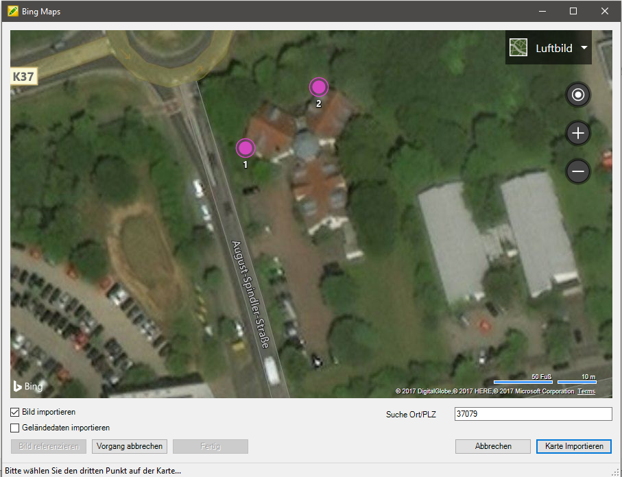
This function is used to reference an existing drawing without a defined coordinate area in the world coordinate system.
Select a point on the visible map section and then the associated reference point in your drawing. Insert at least three reference points in your drawing. The use of at least 3 reference points for alignment is necessary to define the position of the drawing. The algorithm for the calculation is optimal for 3 points. Include the referencing [Finished] .
The possible deviation of the calculated result is independent of the number of reference points: the greater the height differences of the selected terrain points, the less precise the calculated result will be.
If you have the function Reference drawing have already carried out, then you can have another view of the drawing from Bing Maps via the Bing Maps import Add. The map is then inserted in the reference area. So you can add connection cards, for example.
Search city / zip code
In this field you can search for a city, street or zip code.