Table of Contents
What's new?
version 2018
The innovations listed here refer to the entire program. Some functions are license-dependent and are not available to all users.
Digital terrain model
In addition to newly developed functions, the digital terrain model also contains various adjustments to existing functions.
- Point sets from point clouds: You can choose from point clouds imported into the drawing DATAflor Derive points. Thus, the data from the point cloud can be saved in DATAflor DGM can be further processed. During the derivation, the data from the point cloud can be reduced to the bare essentials by selection area and level of detail, so that the data is performant in DATAflor DTM can be processed.
- Deriving Objects: An additional "Dynamic" option has been added for the derivation of geometries. Dynamically derived geometries have the advantage that the derived points adapt as soon as you change the base object change. Also, when the triangulation is created, the triangles are rotated to show the derived geometry.
You can define a selection area in order to derive points only in a certain area. - Point set: The point set now contains an additional tab "Derivatives". On this tab you can change the settings for your dynamic Check derived objects and change.
You can also label points relative to their height to improve clarity. - Profile group: For the profile group there is an additional profile calculation "Manual". Here you can adapt the stationing by adding profiles to the drawing or by deleting them in the list.
If you move, copy or delete individual profiles in the drawing for existing profile groups, the calculation is automatically adjusted to "Manual".
When labeling profile groups, you now have the option of manually using the labeling options% S [23.5] (start value of the profile group is not 0, but 23.5),% S [+] (start value is 0; the value is not displayed as 2900, but as 2 + 900) or% S [+473.5] (labeling as in the previous case; however with 473.5 as the starting value).
- Modeling: When modeling, you can use the option to remove points from the triangulation that have been adjusted in height and not induced by the modeling.
In addition, you can determine which points of the modeling are taken into account when meshing in the triangulation. - Embankment edges: The calculation of the slope edge has been optimized so that the outline is now displayed as a closed line, if possible. Here, for example, valleys are taken into account and crossing slope edges are avoided.
- LandXML export: When exporting in the "LandXML" format, the intermeshed forced edges are now also exported.
Quick-Masses
- Adjustments in the position coupling, the graphic cost estimate, in the topic manager and in the labeling of objects.
- The topic manager now also has the assignment of Line types, i.e. graphics for routes, possible.
- Many optimizations in the display and operation
Plant manager
- With the new version, you can own pictures can be added to plants in their own catalog. These images are then also on the tab Photos displayed in the Plant Manager and in the photo strip.
- The Functions of the heyday calendar have been expanded. The calendar can now be sorted by flowering time. The spacing between the lines can be adjusted and the calendar can be given a title.
- It is now possible Plants without quality insert into a drawing. This applies in particular to working with plants from the Ulmer Stauden DVD.
- The Configuration options for the tree in the plant manager have been expanded. Further nodes can now be shown and hidden in order to better adapt the tree to personal requirements.
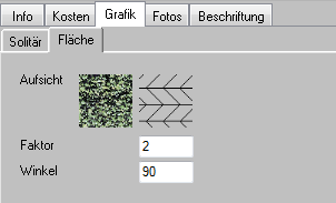
- The Adjustments to hatching and angles in flat plantings are now possible.
- Optimizations have been made in the creation of the Plant legend performed. For example, headers can now be shown and hidden.
- For the Rendering of landscape objects optimizations were made.
- The Attribute flowering time was made available via the web service.
- During the Attribute editing Optimizations have been made for the adoption of changes.
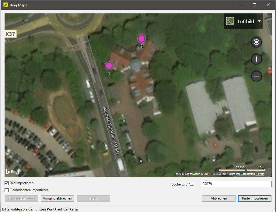
Bing Maps interface
- Since the interface to Google Earth has been discontinued by Google, there is now an interface to the map material from Microsoft Bing Maps. All available options for referencing and import can now be found in a new dialog.
More innovations
- adjustments ZEDIT: As soon as a 3D polyline is assigned the same height, it becomes a 2D polyline. If the height is global, a 2D polyline is created.
- The call of the Point style from the menu is possible again.
- Support of the current versions of SketchUp and Photoshop CC. You can find a list of supported versions here.
Innovations of the version 2017 see here.