Table of Contents
Insert view
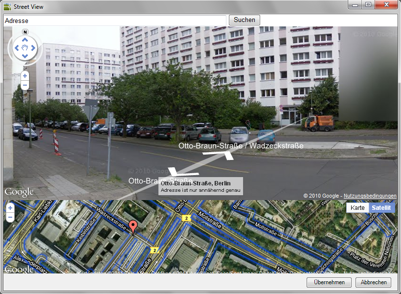
Command: DFSTREET
Description
With this command you import a view from Google Street View as a colored image into your drawing.
Application
- Call the command DFSTREET .
- In the dialog, enter the desired one at the top left Address and click on Search.
Should be searched for Address If no Google Street View data is available, you will be informed of this by message. You can find out which cities Google Street View data is available for on the Internet.
- In the lower part of the dialog you will find the view from Google Earth. The marker shows your current position. You can adjust your position here by clicking and moving.
- The Google Street View view is displayed in the upper part of the dialog. Use the arrows or the mouse to select the desired view.
- Now click the button [Take over] so that the view is inserted into the drawing as an image.
- Use the mouse to define the insertion point and the size of the image to be inserted. The picture is inserted into the drawing and automatically saved.
All images are on the layer Street View created.
If the drawing has already been saved, the inserted Street View images are saved with the drawing name in the same directory. If the drawing has not yet been saved, the images will be in the user directory of DATAflor CAD in the folder Street view filed.