Table of Contents
Coordinate configuration
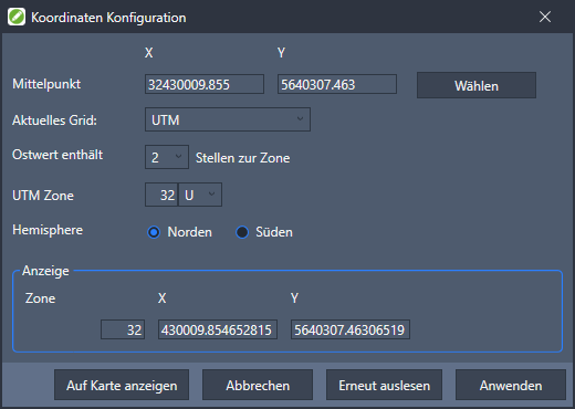
Command: DF COORDINATE CONFIG
Description
In georeferenced drawings, the position of the drawing can be displayed on various maps, eg with GMZOOM. If your drawing is not in the specified grid, use ![]() Configure coordinatesto adjust the coordinates. Interpreted by default DATAflor CAD the stored coordinates as UTM coordinates of Zone 32U. In addition to the UTM coordinates with and without a zone, Gauß-Krüger coordinates with and without meridian strips can also be used.
Configure coordinatesto adjust the coordinates. Interpreted by default DATAflor CAD the stored coordinates as UTM coordinates of Zone 32U. In addition to the UTM coordinates with and without a zone, Gauß-Krüger coordinates with and without meridian strips can also be used.
Functionality
To display coordinates correctly, first select the desired coordinate format in the field Current grid the end. Depending on the format, further details are possible or necessary (e.g. Gauß-Krüger the legal value). The defined format is in the area Advertising shown.
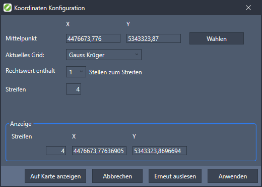
| Select | Allows you to select a point in the drawing to use as the center point. |
| Current grid | Selection of the desired coordinate format. |
| show on map | Opens the coordinates in the selected format in Google Maps. |
| Read out again | Rereads the coordinates of the center of the drawing. |
If the format of the coordinates is unknown, the coordinate converter can be usedhttps://www.koordinaten-umrechner.de to display the location coordinates in various formats.
Gauss-Krüger coordinates
The Gauß-Krüger coordinate system was developed by Gauß for Germany, but is now also used in Sweden, the Netherlands and the RSA. The grid of the geographic coordinates is divided into 3 ° wide meridian strips. The first digit of the coordinate usually indicates which meridian strip the coordinates refer to.
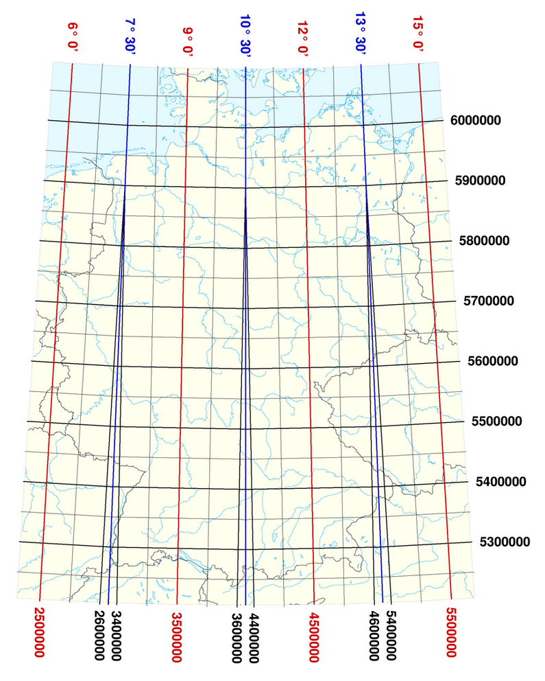
The graphic above shows the usual Gauß-Krüger meridian strips. For example, the strip between 6 degrees and 9 degrees longitude would have to be specified as strip 2, between 9 and 12 degrees as strip 3, and so on. The stripe only needs to be selected if the stripe prefix is missing at the beginning of the coordinate.
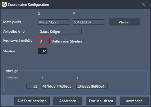
If the stripe is missing in the coordinates or more places are used to specify the stripe, you can go to Easting contains _ digits to the strip select how many places of the coordinates are to be interpreted as stripes.
UTM coordinates
The UTM coordinate system is a worldwide common coordinate system. Similar to the Gauß-Krüger coordinates, the earth is divided into zones (horizontal and vertical).
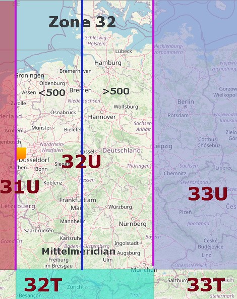
As with Gauß-Krüger, the zone can be placed in front of the coordinate. In this case you can go to CAD under East value contains _ digits to the zone enter how many places of the coordinates must be interpreted as a zone. At UTM you can still use the UTM zone and hemisphere choose. If the coordinate does not contain a zone, it will be in the zone 32U displayed. In the case of UTM coordinates from other zones, this can be set after the number of digits for the zone is on null was asked.
There are inaccuracies in the conversion. With up to 40cm distortion per kilometer, UTM is less precise than the illustration with Gauß-Krüger coordinates. The State Office for Geoinformation Lower Saxony explains the differences here.