Table of Contents
What's new?
version 2022
The innovations listed here apply to all of our AutoCAD-based products:
GREENXPERT, LANDXPERT, CADXPERT and ETB-CAD.
Some functions are license-dependent and are not available to all users.
Also have a look at our webinar on the innovations:
DATAflor GREENXPERT version 2022
Contents of the patches (updates within the version)
DATAflor Object manager

- Completely revised for optimized display and operation
- Lots of new features
- Adaptable to every requirement down to the last detail
- Several dialogs can be used in parallel
- More performance
- Light and dark mode
Mass tree and tools
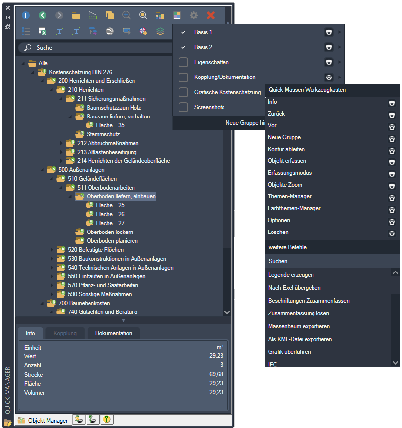
- Better clarity
- Tool box can be individually adapted
- Add your own toolbars
- Integrated search function
- Drag and drop
- Handover of the objects for display in Google Earth
Info dialog
- Context-sensitive representation of the mass tree
- Make changes directly in the object table
- Multiple choice
- Drag and drop
- Context-dependent display of the menus
- Marking important entries
Column selection
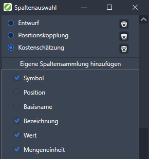
- Easy selection with the plus logic
- Customize object table perfectly for every task
- Add your own column collections
- Quick change between different column compositions
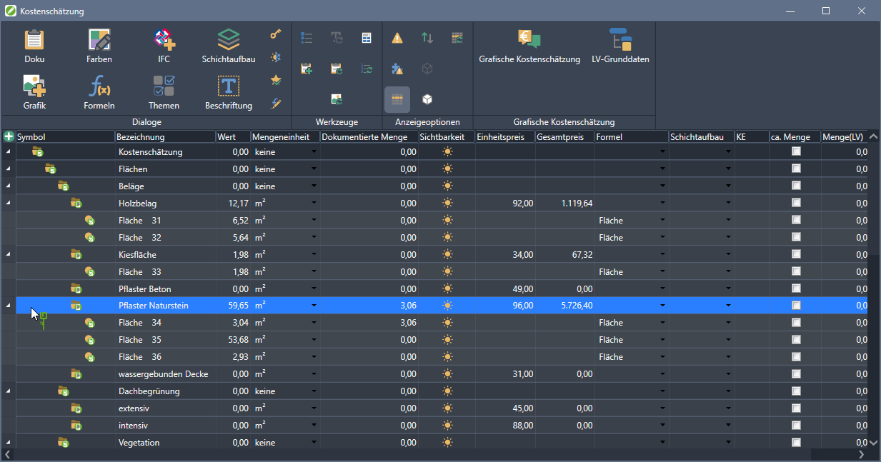
Functions in the menu
- Direct access to available tools
- New: Create and edit formulas
- Efficient use of the object table with the display options, eg object filter
- Several dialogs can be used in parallel
Specifications

- Completion of imported GAEB files and position couplings
- Appending or inserting positions and titles
- Use of standard services via drag & drop
- Create a GAEB file directly from a mass tree
- Output of the GAEB file as a d.8x file
- Writing, updating and exporting quantity statements
- Large projects with more performance through manual synchronization
Layer prefix
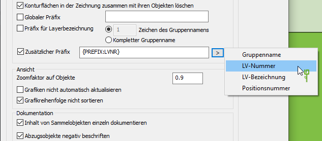
- Additional prefix can be defined for layers
- Selection from a list of predefined variables
- Better filtering of the layers
Formulas
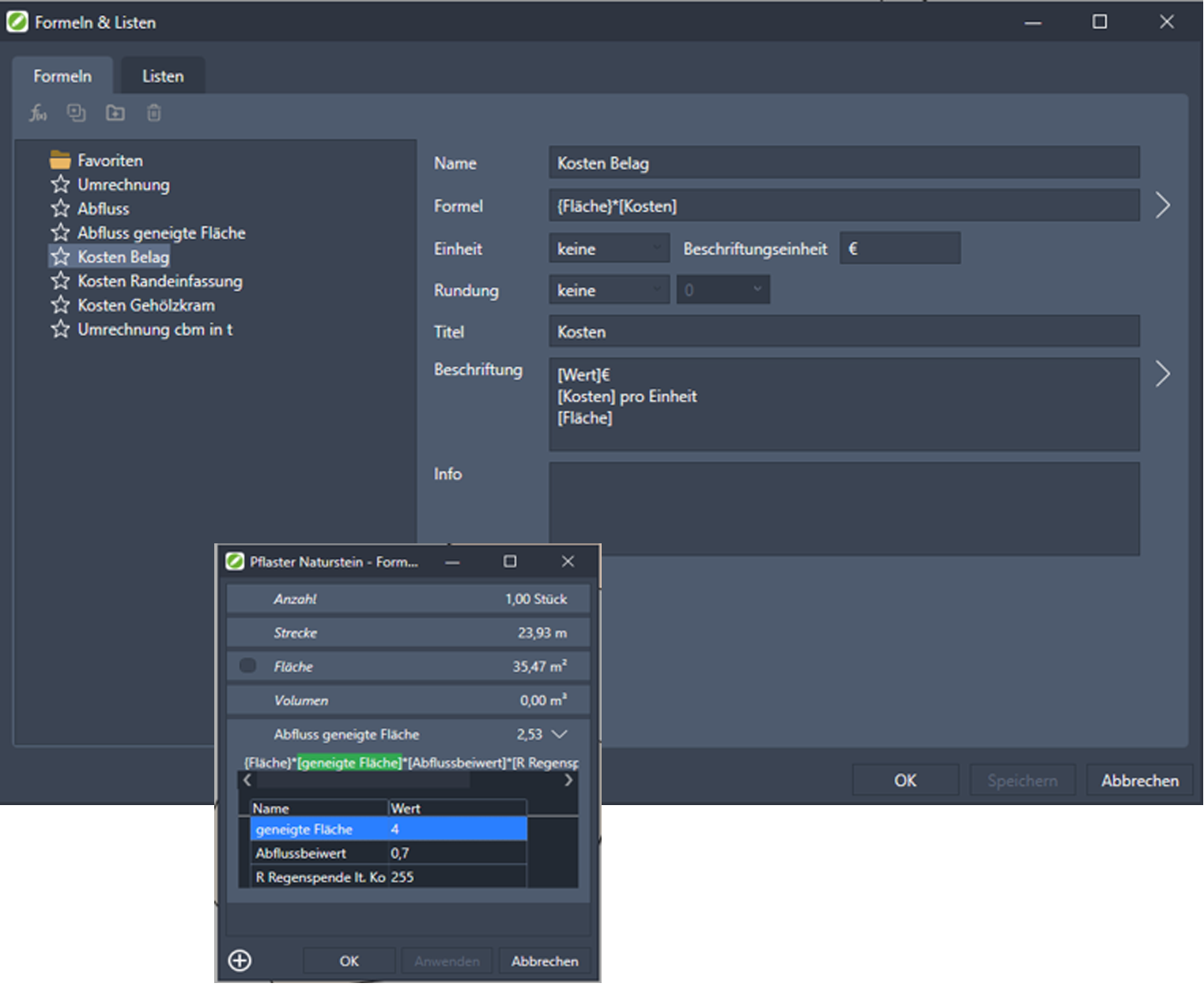
- Easy creation and modification of formulas
- Adding lists
- Use of formulas in formulas
- Wide range of parameters
- Show several formulas in one column of the legend
- Using the formulas for labeling
Digital terrain model
The new DGM motor
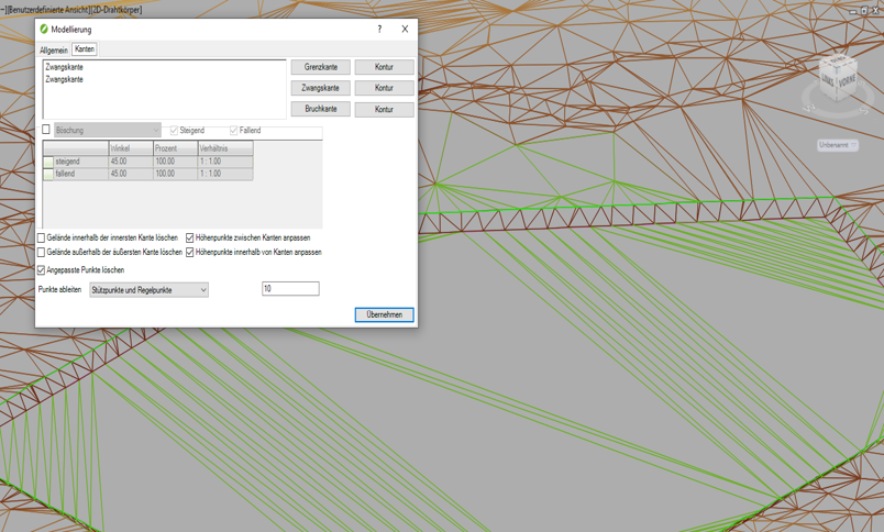
- Processing of larger amounts of points
- Fast and precise meshing
- Exact representation of modeled edges even with large areas
Layer structure
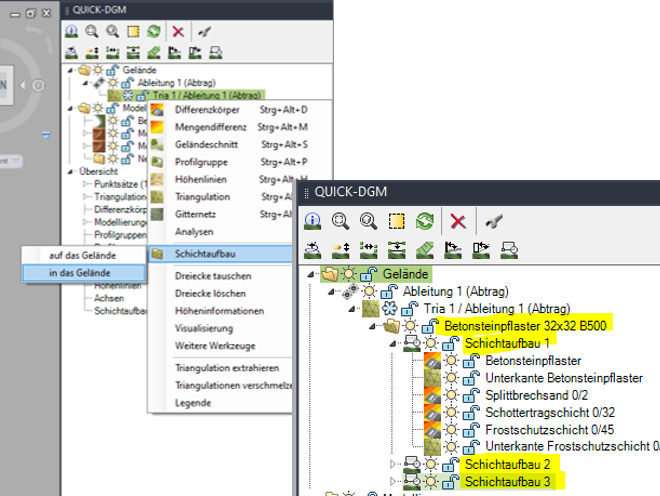
- Assignment of several objects to a layer structure
- Changes in the layer structure update all objects
- Better clarity
Total station import
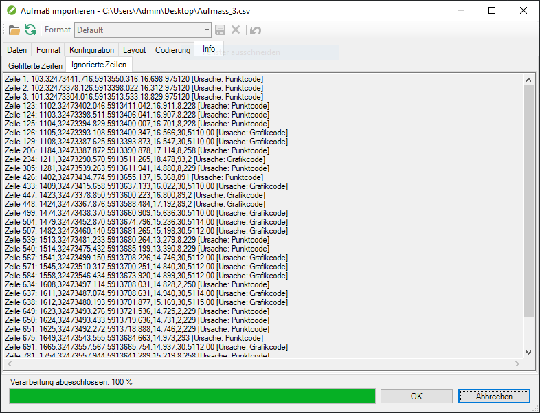
- Improved filtering of incorrect measurement data
- List of faulty lines with line number and cause
IFC
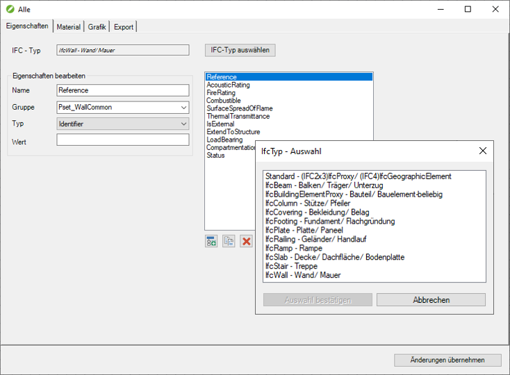
- Extension by various standard classes
- Creation of the associated parameter sets
Coordinate configuration
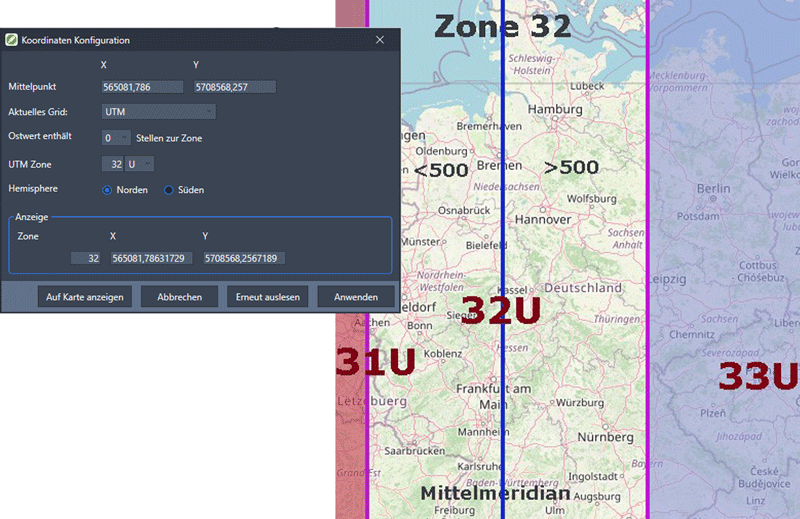
- Configuration of georeferenced drawings
- Optimized coordinates for display in Google, Google Maps and BING Maps
- Display drawings with UTM coordinates with or without a zone
- Display drawings with GK coordinates with or without meridian stripes
- Transfer of captured objects to Google Earth as a KML file
KML files

- Export of KML files to Google Earth
- Display file with assigned objects graphically in Google Earth
- Save the templates of the KML graphics as a graphic theme
Innovations of the version 2021 see here.