Table of Contents
Digitize
Command: DIGIP
Description
With the command Digitize  individual DTM elevation points can be created. This command gives you the option of digitizing or entering height points, which are available as a measurement plan, for example, and thus insert them into the drawing. Then these Combine height points to a point set.
Application
- After the command has been called, an input field for the height appears on the mouse pointer, whereby the value entered last is saved. Either enter a new value and confirm the entry with Enter or just press Enterto use the previous value again.
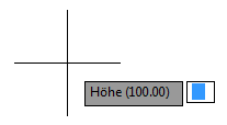
- Now you can define the position of the point in the drawing with one click. You will then be prompted to enter a new height again. With a click with the right mouse button you have the following additional options:
Height: Jumps back to entering the height
Comment: Comment for the next point
Global comment: Comment for all of the following
Alternatively, the point coordinates can also be entered using the keyboard.
Example enter a point: 134.67,254.56 Enter - With ESC or right mouse button and Cancel terminate the command.
Functionality
All newly created DTM elevation points are based on the current Layer placed. You should therefore create and update a new layer before calling the command in order to collect the elevation points on it.
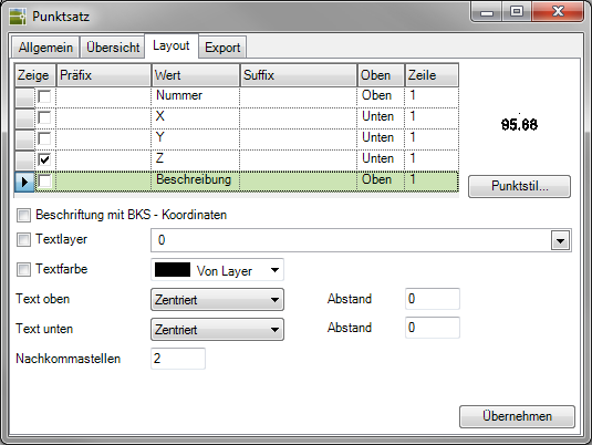
If, despite entering a description, this cannot be seen at the points created in the drawing, this is probably the option Description deactivated for the labeling of the points.
Activate in the info window (see Quick-DTM (AutoCAD based)) on the tab layout the description to the point.