Table of Contents
axles
Description
axles are additional DTM objects that are only required for the LandXML export for the machine control of certain manufacturers (e.g. LEICA) in order to provide additional information for e.g. the location or the course of a trench.
The axes can not can be used to break up a terrain.
Application
Record axes
An axis can only be recorded using drag & drop. Hold down the mouse button and drag the geometry onto the node axles in the tree of the Quick-DTM and then drop it.
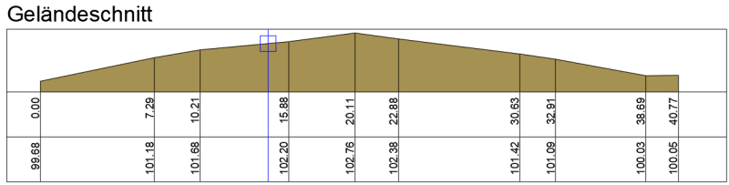
Show axes in profiles
If you are the Info (please refer Quick-DTM (AutoCAD based)) to open the axes, you can go to the tab Group the option Draw in profiles activate.
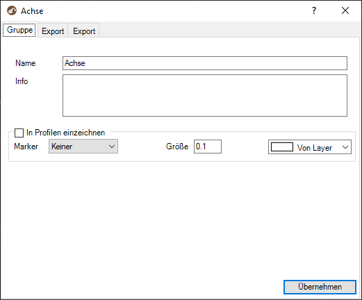
You can specify whether a marker should be drawn in the profile, what the size of the marker should be and the color of the marking on the axis.
When confirming with Apply the axes are drawn in the profile.
If the axis cannot be seen immediately in the profile, the drawing must be made with the command RG be regenerated again.
Export axes
Axes can be exported in LandXML format. The exact procedure for the export can be found under Export as LandXML file.